Main

April 16, 2018

Strategic cycle network map, London

The strategic cycle network map

This is the capital's "strategic cycle network". The thick red lines are the existing routes - the Cycling Superhighways and Quietways, that have been spreading across the capital over the last few years. The thin red lines are those that are currently planned, and the green dotted lines are possible later connections.

If all this is delivered, the strategy says, 70 per cent of Londoners would live within 400m of a cycle route - a distance you can cycle in a couple of minutes.

t6_bikes LondonENG .png

Continue reading "Strategic cycle network map, London" »

April 12, 2018

Sheds and scaffolding of NYC


The de Blasio administration released an interactive map Wednesday showing the location of every sidewalk shed--the reviled wooden structures built to protect pedestrians from construction work happening above (or not).

The sheds, which are often referred to as scaffolding, have drawn the ire of New Yorkers because many owners leave them up for years. In 2016, Crain's looked into the billion-dollar scaffolding industry and the state law that created it and found that there were 190 miles of sidewalk sheds in the city. Some had been standing for well over a decade.

As of Wednesday, there were 7,342 sheds covering 290 miles, a 42% increase since 2016.

September 6, 2017

Big data machine learning insight: pick up trucks voted Bush/Trump, sedans voted Kerry/Hillary

Confirmed by Google Street View.

August 26, 2017

Citibike mapping trips

Every Citibike trip mapped, in N
YC.

June 18, 2017

ZIP code scribble maps

"Scribble Map" by connecting each dot representing each U.S. ZIP code in ascending order.

scribble map of zip codes by Robert Kosara.

ScribbleZIP.png

June 13, 2017

Citibike comes to Astoria with Long Island City expansion

Citibike plan for Astoria and Long Island City, 2017.

May 4, 2016

Regional infrastructure lines and metropolitan clusters

Are regional infrastructure lines and metropolitan clusters are more important than 'states' ?

Britain is also in the midst of an internal reorganization, with the government of Prime Minister David Cameron driving investment toward a new corridor stretching from Leeds to Liverpool known as the "Northern Powerhouse" that can become an additional economic anchor beyond London and Scotland.

Continue reading "Regional infrastructure lines and metropolitan clusters" »

April 2, 2016

Maps, pictures are data

Satellite photos provide a level of geographic specificity that national accounts do not. Another set of researchers used visual algorithms (related to those that recognize your face on Facebook or help navigate cars) to analyze these images pixel by pixel. Through this process, they could quantify poverty in each square kilometer of Uganda.

Satellite photos provide other useful information. In rural areas, we can see crops in the ground, allowing us to estimate harvest size -- even before the actual harvest. This data gives us a direct window into an essential part of the economic lives of many of the world's rural poor. The information can be used to build early warning systems for crop failure, to create crop insurance or target other forms of assistance.

There are many other important, unconventional sources of data. Consider cellphones. For most of the world's poor, each call and text has a very noticeable and real monetary cost.

-- SENDHIL MULLAINATHAN

March 14, 2016

Trumpers are American

The places where Trump has done well cut across many of the usual fault lines of American politics -- North and South, liberal and conservative, rural and suburban. What they have in common is that they have largely missed the generation-long transition of the United States away from manufacturing and into a diverse, information-driven economy deeply intertwined with the rest of the world.


Source Upshot.


TrumpersAmerican2016March.png

March 11, 2016

Trulia maps for choosing a neighborhood

Educated yet ? Via trulia.com/local/.

Northern Queens, how good it is ? Flushing, East Flushing, Murray Hill, Auburndale, Oakland Gardens ?

November 12, 2015

Mind maps of cities, by Archie Archambault

Archie Archambault, a designer who's making an ongoing series called "Map From the Mind." Archambault's maps are based solely on his own explorations and time spent with locals in a given city. "It seems kind of dishonest to make a map completely based on secondhand data," he says. "The tradition of mapmaking is surveying and being within the parameters of the space."

Brooklyn_mind_map.jpg

May 26, 2015

-Shire vs -ton

The Tories are the party of shires and fords, and to a slightly lesser extent of woodland clearings (-ley, -leigh) and woods. Labour meanwhile are the party of -hams (as in, a farm or homestead), of -tons (or towns), and of fields.

shire_ford_ley_wood_ham_ton_field_politics-english-landscape.png

Via KH.

May 21, 2015

Map tracks

Map tracks whole worlds public transit.

Swiss-German IT firm GeOps has collaborated with the University of Freiburg on an interactive map of the world's major mass transit systems.

NYC, NY, via 6sqft.

May 7, 2015

Stigma and Cognition: THE MOST TALKED ABOUT TYPOGRAPHY EXHIBITION AMONG THOSE WHO TALK ABOUT TYPOGRAPHY EXHIBITIONS

S&C New York's recent success with Hangul Typography Exhibition at the Art Directors Club last November has achieved international fame and a documentary film that features S&C New York's activities.

[다큐 공감] 뉴욕, 독도 그리고 "너 빼고 다 아는" from Stigma and Cognition on Vimeo.

Vimeo.

March 21, 2015

Mapping NYC's growth

Mapping how NYC's housing market spurs population change.

CHPC NY's making neighborhoods map.

March 20, 2015

Street score media mit Citymap NYC

Streetscore by media.mit.edu Citymap of NYC: how welcoming are those streets ?

March 17, 2015

Shape of city blocks

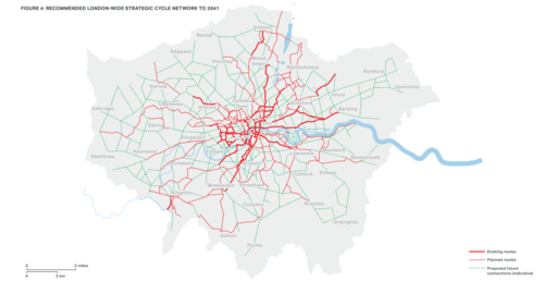
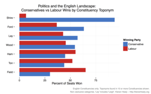
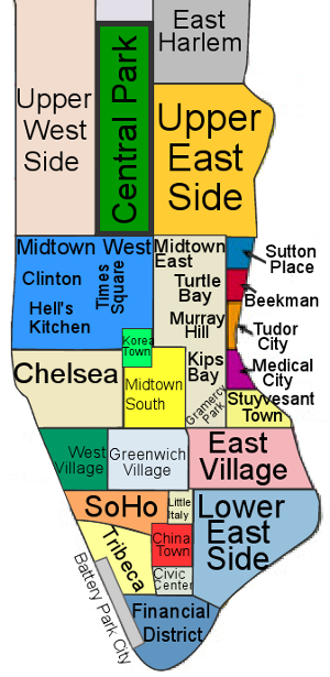
Travel to any European city and the likelihood is that it will look and feel substantially different to modern American cities such as Los Angeles, San Diego, or Miami.

Ref: arxiv.org/abs/1410.2094 A Typology of Street Patterns

The reasons are many. Most older European cities have grown organically, usually before the advent of cars, with their road layout largely determined by factors such as local geography. By contrast, the growth of many American cities occurred after the development of cars and their road layout was often centrally planned using geometric grids.

But while the differences are stark to any human observer, nobody has succeeded in finding an objective way to capture the difference. Today, that changes thanks to the work of Rémi Louf and Marc Barthelemy at the Institut de Physique Théorique about 20 kilometers south of Paris. They have found a way to capture the unique "fingerprint" of a city's road layout and provide a way to classify and compare the unique layouts of cities all over the world for the first time.

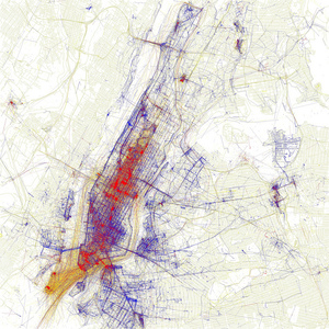
Louf and Barthelemy began by downloading the road layouts from OpenStreetMap for 131 cities from all continents other than Antarctica.One objective way to assess road layout is to think of it as a network in which the nodes are junctions and road segments are the links in between.

The problem with this method is that the networks of most cities turn out to be remarkably similar. That's because the topology captures the connectedness of a city but nothing about the scale or geometry of the layout. It is the scale and geometry of the layout that seem to be the crucial difference between cities that humans recognize.

Louf and Barthelemy's breakthrough was to find a way of capturing this difference. Instead of examining the road layout, they look at the shapes of the spaces bounded by roads. In other words, they analyze the size and shape of the street blocks.

In a city based on a grid, these blocks will be mostly square or rectangular. But when the street layout is less regular, these blocks can be a variety of polygons.

Capturing the geometry of city blocks is tricky. However, Louf and Barthelemy do this using the ratio of a block's area to the area of a circle that encloses it. This quantity is always less than 1 and the smaller its value, the more exotic and extended the shape. The researchers then plot the distribution of block shapes for a given city.

But this shape distribution by itself is not enough to account for visual similarities and dissimilarities between street patterns. Louf and Barthelemy point out that New York and Tokyo share similar shape distributions but the visual similarity between these cities' layouts is far from obvious.

That's because blocks can have similar shapes but very different areas. "If two cities have blocks of the same shape in the same proportion but with totally different areas, they will look different," they say.

So the crucial measure that characterizes a city combines both the shape of the blocks and their area. To display this, Louf and Barthelemy arrange the blocks according to their area along the Y-axis and their shape ratio along the X-axis. The resulting plot is the unique fingerprint that characterizes each city.

When they did this for each of the 131 cities they had data for, they discovered that cities fall into four main types (see diagram above). The first category contains only one city, Buenos Aires in Argentina, which is entirely different from every other city in the database. Its blocks are all medium-size squares and regular rectangles.

January 22, 2015

Train to Planes, Cuomo to Laguardia LGA JFK NYC

For: van shnookenraggen.

Against: the transport politic

LGA-subwaymap.jpg

August 9, 2014

New York speaks

Local languages via BI and .

most-common-nyc-non-english-langauge-excluding-spanish.png

most-common-nyc-non-english-language-including-spanish.png

February 25, 2014

Better track geography and know where stories are being published and talked about

Going forward, this study provides an interesting foundation for thinking about how our media are interrelated, and how various facts, anecdotes, and bits of misinformation make their way to the public.

"Can we start exploring the data not from identifying these topics of keywords upfront, but asking an algorithm to surface some of those for us?" asks Graeff. "What are some unusual things or clusters of news stories that will allow us to get a sense of news stories that otherwise wouldn't be seen?"

In the future, Graeff says he'd like to be able to better track geography and know where stories are being published and talked about. The team is also interested in using natural language processing to track the spread of quotations from source to source. In addition, "automated coding and sentiment analysis" could be used to better understand how perspectives in the newsroom are molding stories -- tools like OpenGender Tracker.

Ultimately, the goal is to create a suite of tools that activists, journalists, and academics can learn from. Says Graeff: "A lot of what we show here is that there are better methods for studying the media as a so-called media ecosystem that allow us to really understand how a story goes from barely a blip to a major national/international news event, and how controversies circle around that."

June 2, 2013

Locals vs tourists map by untapped cities and Eric Fischer


Tourists are red, New Yorkers are blue. Locals vs tourists map by untapped cities and Eric Fischer.


NYC_locals-and-tourists-map-Eric-Fischer-Untapped-Cities.jpg

Continue reading "Locals vs tourists map by untapped cities and Eric Fischer" »

March 12, 2013

Proximity in location-distance, or time ?


This post has been revised to reflect the following correction:

Correction: March 11, 2013

The Grindr app locates other people by distance, not time, as a previous version of this post stated.

The application focuses on proximity rather than location -- showing people's distance.

Continue reading "Proximity in location-distance, or time ?" »

November 23, 2012

Neighborhood map of NY, simplifed

NYC-Manhattan-Neighborhood-Map.png

Via RealestatesalesNYC.com

November 3, 2012

Sandy Superstorm impact maps for NY


Google Crisis Map: google.org/crisismap/2012-sandy-nyc

LIPA: LI Power outage map : www.lipower.org/stormcenter/outagemap.html

September 9, 2012

Uber #2


Taxi officials say that Uber's service may not be legal since city rules do not allow for prearranged rides in yellow taxis. They also forbid cabbies from using electronic devices while driving and prohibit any unjustified refusal of fares. (Under Uber's policy, once a driver accepts a ride through the app, no other passenger can be picked up.)

Cabbies using the Uber app receive a smartphone loaded with its technology, which tries to predict areas where rides are in high demand. The driver nearest to a requested pickup location receives a notification and is given 15 seconds to respond.

Travis Kalanick, Uber's chief executive, rejected criticisms that the service violated city rules against prearranged yellow-taxi rides. "Prearrangement means it's basically on behalf of a base," he said in an interview. "We're not working with a base."

David S. Yassky, the chairman of the commission, said only that the city had "led the country in terms of putting new technology to work for riders" and noted that the commission was currently requesting proposals for a smartphone-based payment system.

At the meeting, officials raised concerns about a regulatory issue that would prevent Uber from processing credit cards for taxi rides, according to Mr. Kalanick.

Mr. Kalanick said he had agreed to make the app's new services available for no charge for the next week, so that riders could "get a taste of the future," while the two sides try to resolve the regulatory concerns.

Uber is one of several start-ups, like Taxi Magic and GetTaxi, trying to profit by connecting drivers and passengers more efficiently. Another company, Hailo, said it had already registered 2,500 drivers to use a similar service that it planned to unveil in the coming weeks.

Continue reading "Uber #2" »

November 25, 2011

Start up in Manhattan: the map


Startups cluster from Broadway to rand Central in midtown, down to SoHo.

1120STARTUPSUB.png

Continue reading "Start up in Manhattan: the map" »

July 11, 2011

NYC by day, by night, where the people are


Bedroom communities or nightlife ? Map of NY.

nypopdaynight.jpg

Continue reading "NYC by day, by night, where the people are" »

April 14, 2011

Ten most segregated cities by Census 2010


Ten most segregated cities by Census 2010, by Salon with maps.

June 27, 2010

Gulf Oil Spill


Gulf Oil Spill: more damage or cleanup ? What should we expect from BP ?

bp_oilspill_map_2010june.jpg

December 11, 2009

Wayfinding by chirping sparrows in Penn Station

Q. Every time I wait in the Long Island Rail Road section of NYC Pennsylvania Station, I hear chirping, tweeting birds. The sound is louder near overhead speakers, so I'm assuming it's a recording. Is it supposed to make passengers calmer, like Muzak?

A. You are hearing a "talking kiosk," designed to help visually impaired passengers and others navigate the confusion of the station. The kiosk is in the Long Island Rail Road's main concourse, between the entrances to Tracks 14 and 15.

"To help visually impaired customers locate the kiosk, it emits the song of the lark sparrow (Chondestes grammacus), a bird species native to the American West, that is found by audiologists to have a unique set of phonetic properties considered effective for directional way-finding," said Susan McGowan, a spokeswoman for the railroad.

The current model was installed in December 2008, replacing an older one that also chirped. This one features a touch-activated tactile map of the station, visual displays for the partially sighted, and a voice designed for phonetic clarity, Ms. McGowan said in an e-mail message. As a customer touches different parts of the map, the kiosk describes the location and gives directions. It also offers general information about Penn Station and the Long Island Rail Road.

May 30, 2008

Subway Maps, overlay, by on ny turf

onnyturf overlays subway maps with street maps for New York City.
Useful ! And updated.

October 4, 2007

Zip Skinny

ZipSkinny provides demographic info by zipcode: Plandome, NY 11030.

March 10, 2007

Queens' Crap

QueensCrap:

Curbed on over development,
Infill slums vs Broadway Flushing Auburndale area
(the "privileged" community far to the east of downtown).

Immigrant storage (57th Avenue, east of Van Horn Street in Elmhurst).

Flushing is starting to to look worse than a scene from Blade Runner.

Continue reading "Queens' Crap" »

September 4, 2006

Get caffeinated map

Coffee map, cups around town.

August 18, 2006

subway map mashup for NYC

google-subway map mashup by onnyturf.
See previously: Dynamap layered map.

June 26, 2006

NY Real Estate maps: Shark Bites

Curbed and Property Shark team for NY Property Map theme of the week at Shark Bites.

March 3, 2006

CA Quake mapped

Earthquakes: CA quake map.

January 1, 2006

Fairfield, CT map

Map for Fairfield, CT and Westchester, NY commuting locations.

December 18, 2005

Google Earth

For GPS, GIS map junkies: google earth for Mac OS X.

December 13, 2005

Wayfaring DIY maps

Wayfaring makes mapmaking easy.
Ex. SFR SCCA solo2 (autocross) sites.

December 6, 2005

Google maps mania

Google maps mania charts the
mash ups and applications.

November 8, 2005

Arctic MINI map and photo mashup

NoNo's Arctic MINI map and photo mashup is live.

November 7, 2005

Tour de NORD: Hudson Bay or Bust III

Mapping the 2006 arctic expedition.

Newfoundland coast

Planning threads:
MINI2
NE MINI
Arctic MINI reference by Ross Trusler.
Itinerary

More about Newfoundland:
Picture gallery by Jerry Curtis.

Weather:
Saint John's: BureauMétéo
Increasing cloudiness. Snow at times mixed with ice pellets beginning overnight.
Snow and ice pellet amount 5 to 10 cm. Wind becoming east 20 km/h then increasing
to 40 gusting to 60 overnight. Temperature rising to zero by morning.

October 14, 2005

housing map 2

census track vs google map mash up.


Continue reading "housing map 2" »

September 30, 2005

Housing Map

Housing Maps
the criagslist - googlemap mash up.

See also housing maps by census.

Live near the trees.

Continue reading "Housing Map" »

April 10, 2005

Craig's List and Google Maps

Craig's List and Google Maps merge, and the result is good.

See for rent and for sale listings plotted on a map,
pins colourized to show availability of pictures,
drill down the matches to a feature set or price band.